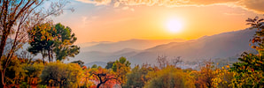
Alpujarra walks
Number Six: La Cebadilla
|
|
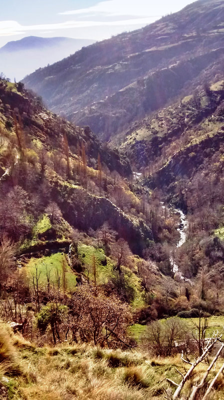
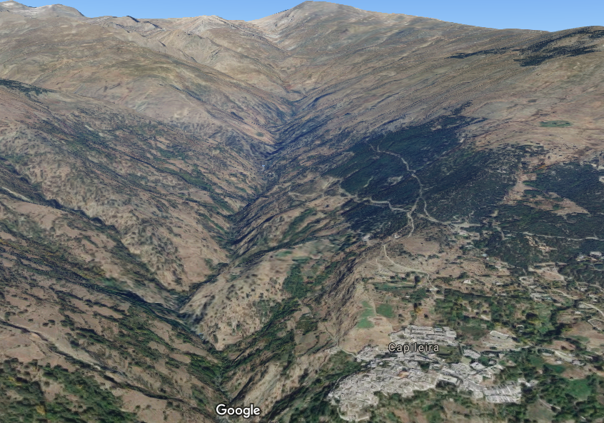
From Capileira up the Poqueira Gorge to the beginning of the Poqueira River and back along the other side of the gorge.
|
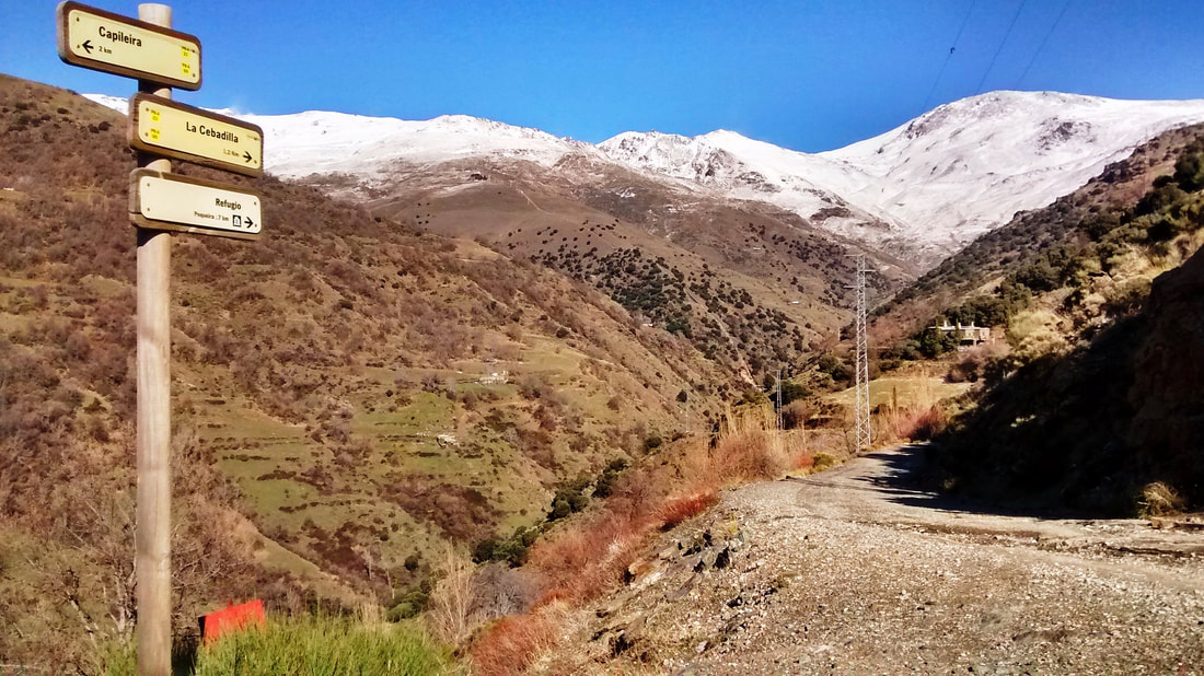
La Cebadilla circular walk
Duration: 3 hrs 15 mins walking Length: 7.5 km Difficulty: Easyish. Straightforward to follow. One of the very best walks from Capileira, the route provides wonderful sights and views both on the way up the gorge and coming back. You cross the river twice and have a ghost village thrown in for good measure.
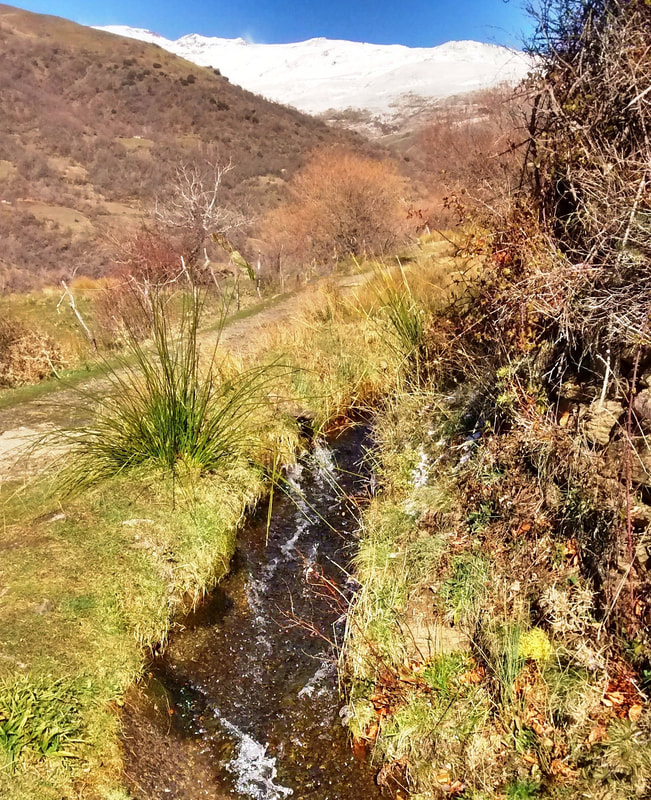
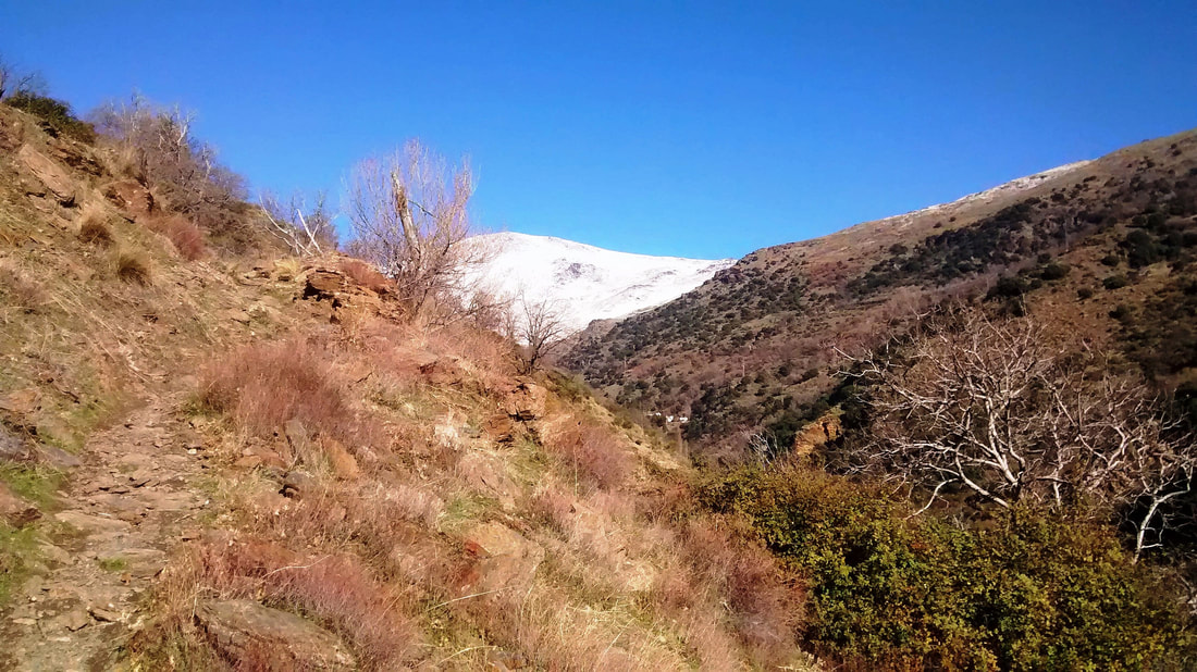
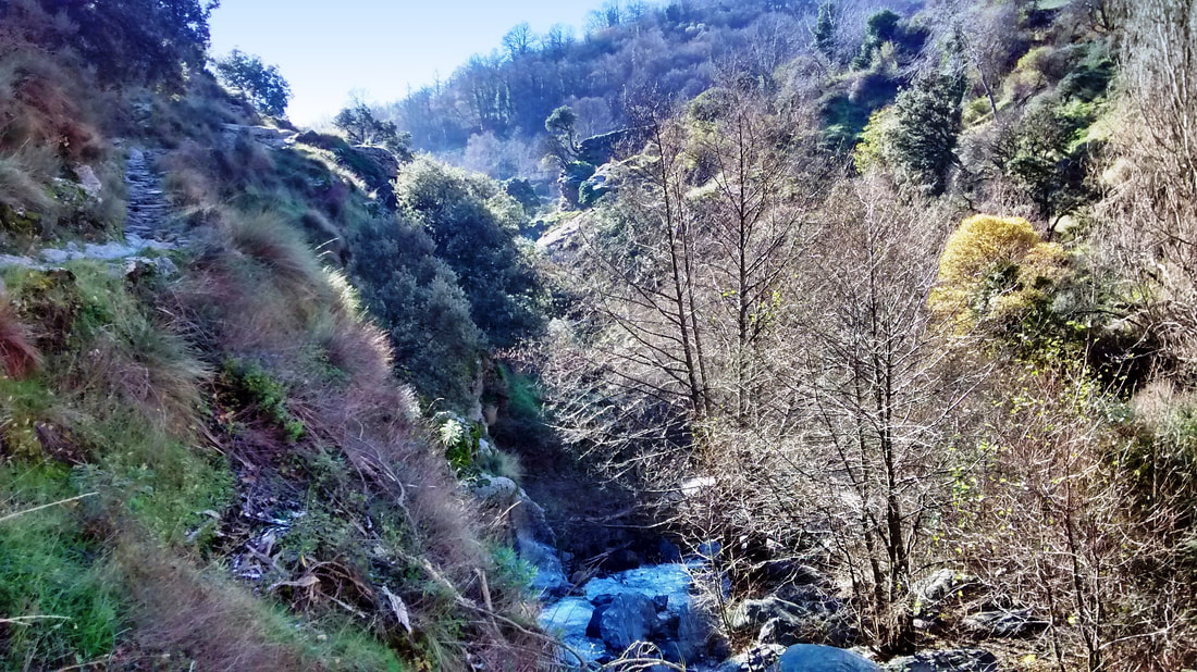
La Cebadilla walk, signposted for wayfarers by yellow-and-white posts with the identifier PR-A 69, will always be known to me as the Porridge Walk, as it was a sturdy, gut-sticking December breakfast that sustained me throughout. A sunny morning close to the winter solstice and frost patches the steepness of the Poqueira Gorge opposite Capileira. It’s cold but not that cold. We are high up but still in Andalucia, after all. The pristine air and spankingly clear sunlight fairly yells at the sedate householder to pull boots on and get out there. This route heads straight up the gorge towards the peaks of Sierra Nevada. |
|
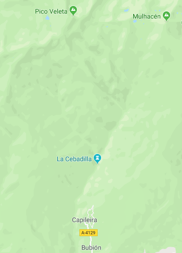
La Cebadilla map
|
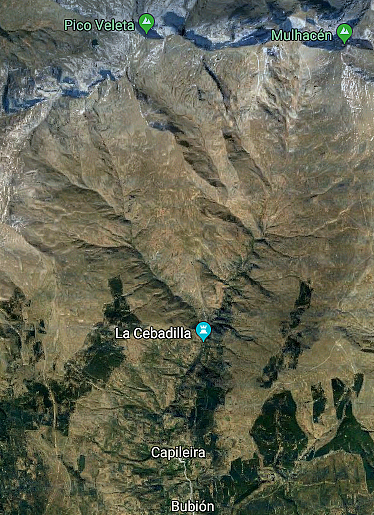
Click on images to enlarge them
|
|
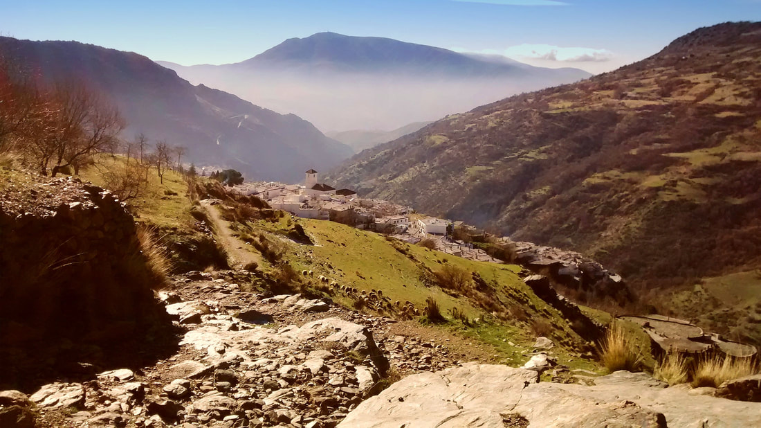
The walk begins directly above the car park at the end of the street on which the main supermercado is situated. A street rises past the last of the houses and quickly turns into a path. Hasta luego, Capileira!
We leave Capileira behind
At a plain white hut whose resident monster gurgles and belches as it cleanses drinking water destined for Capileira, you have already a clear sight of Veleta’s fin-like peak.
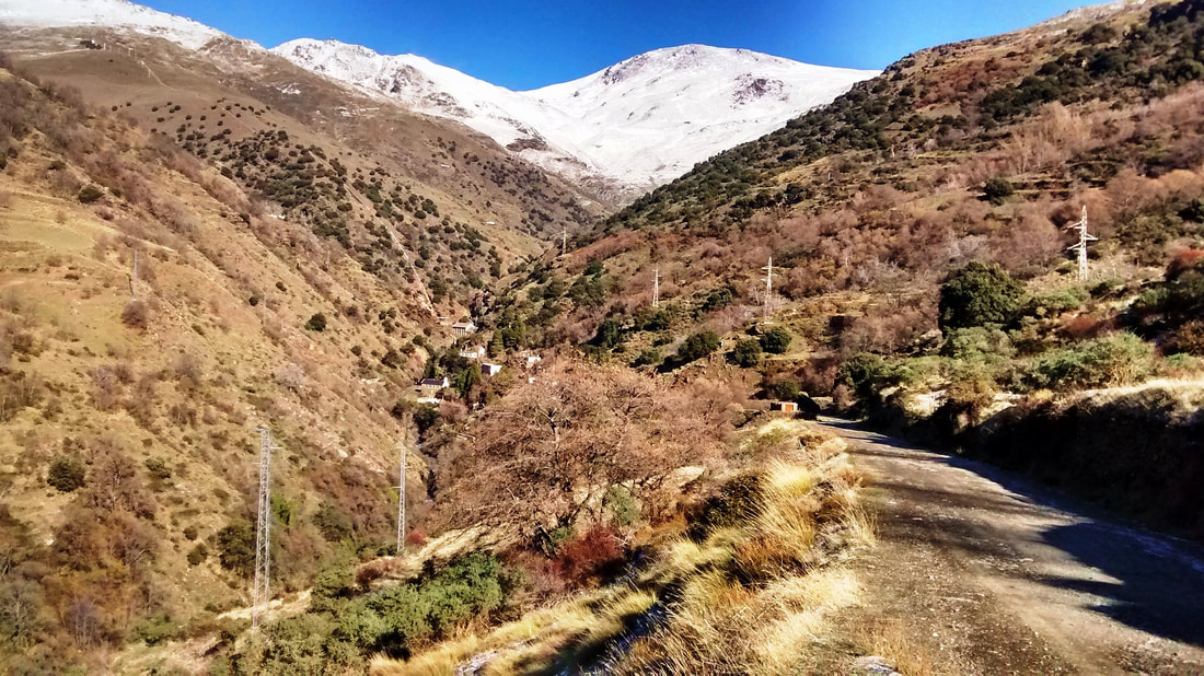
Sleepy Capileira recedes like a pretty dream and before you know it, after a greeting to a shepherd, the village vanishes and you are heading up the gorge.
Sleepy Capileira recedes like a pretty dream and before you know it, after a greeting to a shepherd, the village vanishes and you are heading up the gorge.

|

|
|
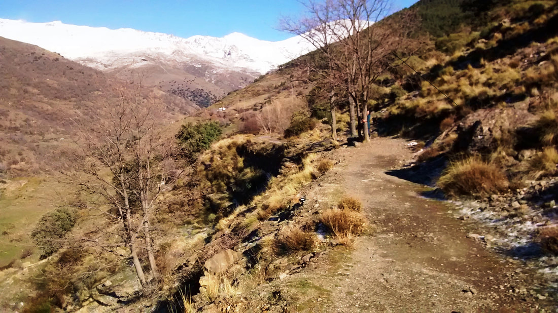
There’s no stopping you. Boots crunch the sparkling ice of a frozen puddle and then the way is clear, the December sun warming, the path and the mountainside so illumined, the air itself so fizzing and bright that you feel like stripping off Jack naked and striding away with a tra-la-la... Well, you might and you mightn’t. Let’s get on with the itinerary.
When you come to a round water treatment plant, skirt round it to the left and you’ll see that the path continues.
Depending on the time of year, you may hear and see more water hurrying down an acequia just above. This joins with others at a major irrigation junction further along. |
|
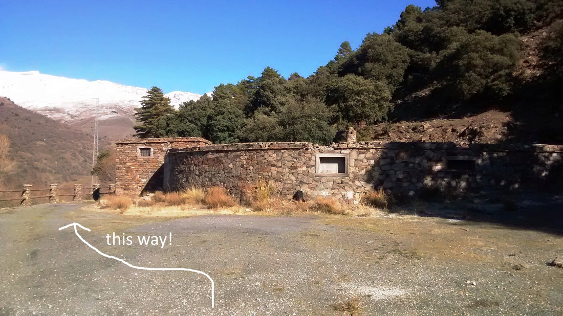
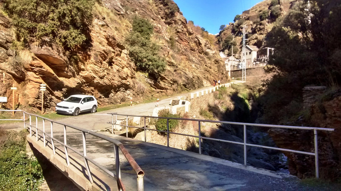
Your path emerges onto a broad, driveable track to La Cebadilla. Driveable because it leads to the hydroelectric generating station which will mark the apogee of this walk.
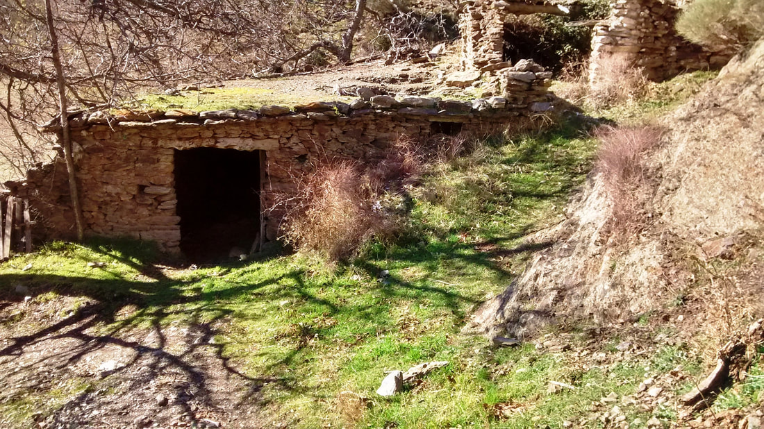
The building of the generating station explains the existence of the Poblado, complete with school and chapel, which served in the 1950s as housing for as many as 200 workers. Every couple of days, a volunteer would set out on a mule to bring back milk, tobacco, wine and other essentials from one of the villages down the gorge. Today, it is a ghost town and the buildings you amble past are decrepit and lifeless. The spirit of a Moorish princess is said to wander these parts, but the only inhabitant I saw was a lone black bull, silent and impassive.
The building of the generating station explains the existence of the Poblado, complete with school and chapel, which served in the 1950s as housing for as many as 200 workers. Every couple of days, a volunteer would set out on a mule to bring back milk, tobacco, wine and other essentials from one of the villages down the gorge. Today, it is a ghost town and the buildings you amble past are decrepit and lifeless. The spirit of a Moorish princess is said to wander these parts, but the only inhabitant I saw was a lone black bull, silent and impassive.
Turn left onto the track
|
The ghost village ahead
|
The path continues down to a bridge over the river, following which the walk turns left to loop back to Capileira.
However, having come this far you may be curious to take a brief diversion to the right and walk a little further up the gorge to see not only the hydroelectric station, alien in its natural locale, but also, at the same site, the confluence at 1,540 metres above sea level of the rivers Naute and Toril, whereafter the river is known as the Poqueira.
Let us return to the bridge and that left turn to head back down the other side of the gorge. It is signposted for Capileira PR-A 69 and Puente Abuchite.
Turn left after the bridge
|
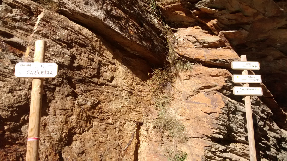
Follow signs for Capileira & Puente Abuchite
|
Abandoned cortijo
It makes excellent timber for roof beams, railway sleepers, furniture or firewood. Its tannins are used for tanning leather and absorbed from oak barrels to give wines a particular profile. |
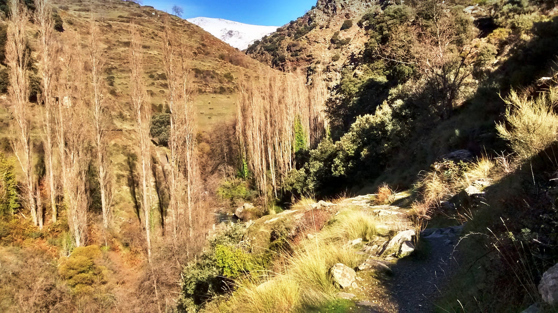
Ascending and descending by turn, the path negotiates crags and folds in a mountainside populated by Pyrenean oak and scrub, an occasional horse, but no people. Along the way you see the ruins of the simple stone dwellings where locals used to spend summers growing wheat for flour, corn and potatoes, tomatoes, peppers and tomatoes and keeping sheep, goats and pigs for the year’s meat. What may sound a bucolic lifestyle was really the toughest of existences, no more than subsistence, hacking the flinty ground into submission to channel irrigation water and yield their simple produce. Alongside the cortijos you will often see an era: an exposed, rounded space of flat stones, where the wheat was threshed. The advent of tourism put a welcome end to this hardship and the cortijos, which were accessible only by long treks, are now abandoned and in disrepair.
|
What is unchanged is the extraordinary beauty of the landscape. It will stay as lovely all the way back to Capileira.
|
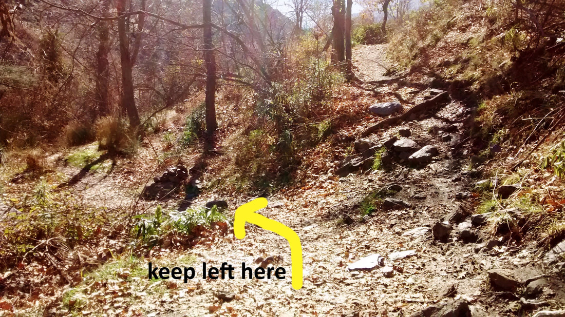
Where the way appears to divide, take the lower path. This is the only moment of doubt on a reassuringly obvious route.
|
|
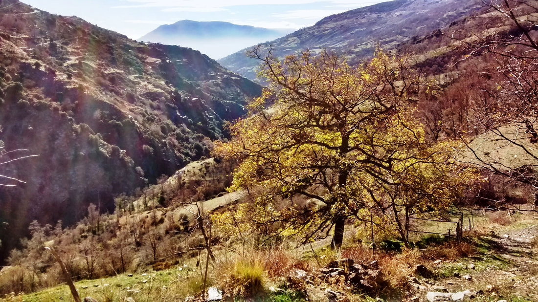
The path reaches a lovely point where the two opposed mountains north and south, Mulhacén and Lújar, are visible as distant reflected opposites, each rounded like a pudding, brilliant white in snow and sun, one shaded in grey. The day I stood there, the air was perfectly still, sunlight bared all manner of greens and greys on the other side of the gorge, and the thin clouds over Sierra Lújar resembled cuttlefish. Below rushes the river and you now descend to its wooded banks.
Mulhacén to the north
|

Lújar to the south
|
Below rushes the river and you now descend to its wooded banks and Abuchite bridge.
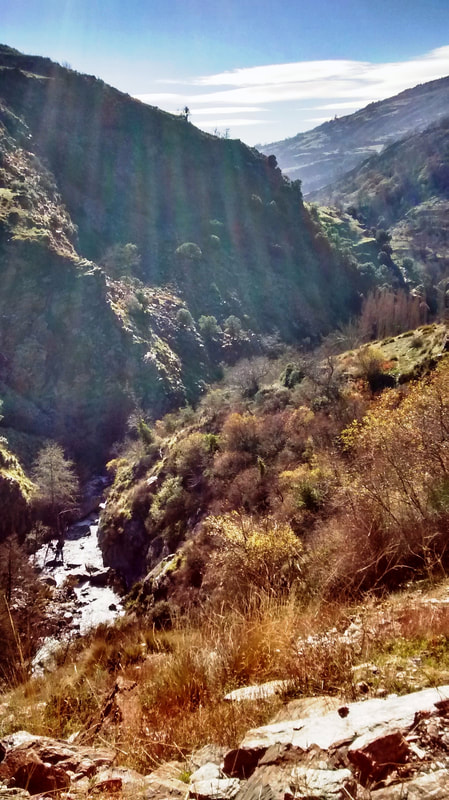
The Poqueira river running through its gorge
|
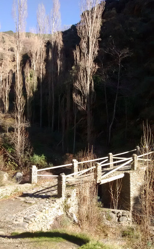
Puente Abuchite
|
At the Abuchite bridge, the riverside is a pleasing spot to rest in the shade of the tall poplars.
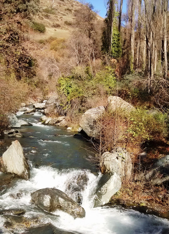
River Poqueira at Abuchite bridge
Cross the bridge and the path climbs, presenting splendid view after splendid view.
|
|
Eventually, the path broadens and levels out, making your return to the Capileira that much more gratifying. You reenter the village just below the main square. Water fountains and peaceful bars with terraces await the thirsty wanderer.
That's all, folks!
Back to: Alpujarra Walks
